Sports
Marin's High Country Atop Mount Tam
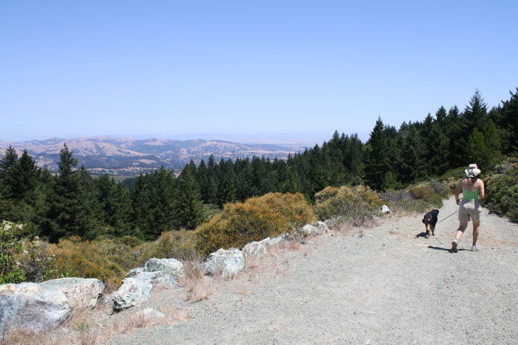
A four mile (or longer) hike though several old camps (now picnic areas), a large high meadow, and culminating atop Tam's West Peak at the old Mill Valley Air Force Station for fantastic views all around. Dogs on leash OK.


This week we wanted to get on top of it all and explore some of what we call Marin's high country. We are not talking alpine forest, but on the northwest side of Mount Tamalpais are high meadows, rough rocky terrain, secluded picnic areas and fantastic views in all directions. This area was a popular destination in the early part of the 1900's for its beauty and seclusion. For this reason there are numerous old camp spots where hunters and other outdoorsmen built summer retreats.
This area around West Peak of Mt. Tam can be reached with relative ease if you drive up and park at the Rock Springs Parking Area near the Mountain Theater. On the day we headed up there was an ocean of fog packed around the west side, so we chose to hike just over the ridge to explore the meadows, forests and peaks. Our loop passes through Barth's Retreat, Potrero Camp, Potrero Meadow, Rifle Camp, and the old Mill Valley Air Station on West Peak.
From the parking area we heading out on Simmons trail to Barth's Retreat. The Simmons trail passes over a rocky ridge of greenish serpentine. Here stunted junipers, manzanita, bunch grasses and occasional firs line this loose rocky trail. Once over the pass you drop into fir forest and end at Barth's Retreat picnic area. Here Emil Barth, a pianist and avid hiker, built his camp in the 1920's. A small stream, picnic tables and a BBQ are available.
Find out what's happening in Mill Valleywith free, real-time updates from Patch.
Next we headed over to the nearby Potrero Camp, another area with picnic tables and BBQs, to catch the trail that heads up and through Potrero Meadow. This is the largest meadow on the slopes of Mount Tamalpais and amazingly flat. As you pass through the meadow and approach the higher east side there is a lone oak tree on the north side with several flat rocks under its shady branches. This is one of our favorite places watch the dragonflies, birds and other wildlife across this vast meadow.
From here you continue to Rifle Camp and catch Arturo trail, which climbs up through a stand of huge fir trees to the site of the old Mill Valley Air Force Station. This trial was reopened in the 1980's after the Air Force gave the land back to the MMWD. Once you reach the top, follow the road up into the old air station. The west peak used to be the tallest of the three peaks until it was flattened to build the air station. There are amazing views of Tomales Bay to the north and the Golden Gate to the south. Follow the main paved road to the very end and you will find an un-named trail that leads down to Rock Springs Fire Road where you can catch Benstein Trail back to the Rock Springs Parking area by heading right on Rock Springs.
Find out what's happening in Mill Valleywith free, real-time updates from Patch.
Be sure to bring a map if you are unfamiliar with the area. All the maps we had all incorrectly showed the route of the trail from the air station to Rock Springs. Otherwise the maps were very helpful. There is no drinking water in this area, so bring plenty. Also it is fun to have some nice food to take advantage of the numerous picnic spots. As long as you stay off the Coast side of the ridge you can bring your leashed dog.