Sports
Climb to the Fire Lookout Atop Mt. Barnabe
From mountains to sea, Tamalpais to Tomales, the view from the top of Mount Barnabe brings West Marin together. 8 to 10 miles and 1600' of climbing. Steep in places. No dogs.

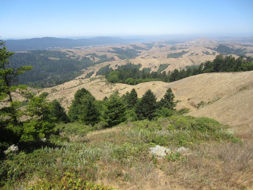
With a peak height of 1466 feet, Mt. Barnabe offers one of the great viewing spots of West Marin. On a clear day you can see Tomales Bay to the northwest, Mt. Diablo to the east and the jutting profile of Mt. St. Helena to the north. Also, Mt. Barnabe sits in a unique central position relative to the ridgeline running from the East Peak of Mt. Tamalpais to Bolinas Ridge. The ridgeline spans a full 180 degrees from southwest to northeast.
This week, we wanted a challenging outing with a visual feast as a reward. The trek to the top of Mt. Barnabe fit nicely into our plans. There are really just two options for getting to the top. The first is long (8 miles) and steep (25 percent in places). The second is longer (9.5 miles) and steep for the last half-mile. Either way you are going to get a workout.
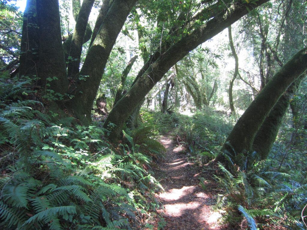
Both options start by parking at the Devil's Gulch trail head, which is one mile past the Samuel P. Taylor State Park entrance. Park and cross the street and head up the paved road. Just a few hundred yards in there is a small trail on the right that follows the creek to a bridge. Just across the bridge is Bill's Trail to the left and Mt. Barnabe Fire Road to the right. Bill's Trail is the longer way up, but a much easier and even gentle grade. The 3.5-mile trail switches back and forth through shaded fir and fern forest. Maples and hazelnuts are found in the moister areas. Bill's Trail ends a half-mile shy of the peak on Mt. Barnabe Fire Road.
Find out what's happening in Mill Valleywith free, real-time updates from Patch.
The shorter (by 1.5 miles) and much steeper way is to go is up the open and grassy ridge line via Mt. Barnabe Fire Road. The habitat here is hot savanna in the summer, with occasional bay trees, coyote bush and other shrubs. If you go this way, head up early to beat the heat. Many sections of the road are 20 percent or greater, with one spot reading a 25 percent grade on my Garmin GPS unit.
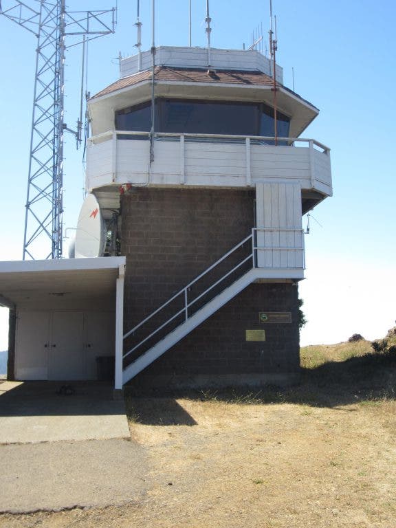
At the top, you are rewarded with fantastic views. The Dickson Fire Lookout is perched on the highest point. The lookout was put into service in 1935 and is still used today. Be sure to travel around the base and take in the view from all 360 degrees.
Find out what's happening in Mill Valleywith free, real-time updates from Patch.
When you head down, go back the same way you came up. Mt. Barnabe Fireroad has two paths with the more eastern route ending on the Cross Marin Trail, which is currently closed (closed weekdays between 7 a.m. and 3 p.m. for construction). The Cross Marin Trail will reopen at the end of September.
See the book "Hiking Marin: 141 Great Hikes in Marin County" for more details. Click here to go the Marin Trails website, where you can find more information about the book.